

#Alongthewallin80days - Day 64
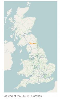
The Military Road is a name given locally to part of the B6318 road in Northumberland, England, which runs from Heddon-on-the-Wall (54.9974°N 1.7929°W) in the east to Greenhead (54.9820°N 2.5344°W) in the west.
For much of its length the road is straight and displays the characteristics of a Roman road. However the term "military road" comes from the building of the road by Hanoverian forces in 1746 in order to suppress the Jacobites to the North.
The main feature of the road is that it runs alongside Hadrian's Wall for much of its length, and some parts of the road are built on the foundations of the wall.