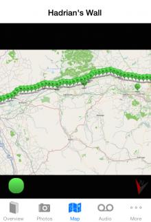
We are down to the last 20 milecastles of our #AlongTheWallIn80Days blog. The final 20 milecastles and their locations are listed below and can be easily located using out Hadrian’s Wall iPhone App, available to Download here.

Milecastle 0
Longitude -1.527508
Latitude 54.988500
Milecastle 1 - Stott's Pow
Longitude -1.549878
Latitude 54.983879
Milecastle 2 - Walker
Longitude -1.566136
Latitude 54.979656
Milecastle 3 - Ouseburn
Longitude -1.589073
Latitude 54.975895
Milecastle 4 - Westgate Road
Longitude -1.621547
Latitude 54.970478
Milecastle 5 - Quarry House
Longitude -1.629907
Latitude 54.971638
Milecastle 6 - Benwell Grove
Longitude -1.664694
Latitude 54.975868
Milecastle 7 - Benwell Bank
Longitude -1.676142
Latitude 54.980236
Milecastle 8 - West Denton
Longitude -1.701585
Latitude 54.986408
Milecastle 9 - Chapel House
Longitude -1.722388
Latitude 54.990692
Milecastle 10 - Walbottle Dene
Longitude -1.743496
Latitude 54.994900
Milecastle 11 - Throckley Bank Top
Longitude -1.766747
Latitude 54.996048
Milecastle 12 - Heddon
Longitude -1.789794
Latitude 54.996902
Milecastle 13 - Rudchester Burn
Longitude -1.813019
Latitude 55.000343
Milecastle 14 - March Burn
Longitude -1.834940
Latitude 55.003567
Milecastle 15 – Whitchester
Longitude -1.856919
Latitude 55.005615
Milecastle 16 - Harlow Hill
Longitude -1.879653
Latitude 55.009209
Milecastle 17 - Welton
Longitude -1.903682
Latitude 55.008499
Milecastle 18 - East Wallhouses
Longitude -1.925761
Latitude 55.009674
Milecastle 19 - Matfen Piers
Longitude -1.949295
Latitude 55.011387
